Road Design and BIM
Civil 3D and Infraworks
While I was working at KBR in Qatar in the role of a visualization technician, I was reviewing Civil 3D design models of the highway projects and utilities, as well as reviewing visualizations, on the Expressway Programme which is one of the biggest infrastructure projects in the world. I helped with the definition of CAD and BIM standards, and the implementation and adoption of BIM into the Programme and in the Public Works Authority of Qatar as a whole. I also worked on the creation of several visualizations as well, for which I had to create Civil 3D models first, based on the 2D design drawings, so that I would be able to import them to 3DS Max and start the work on the visualizations itself.
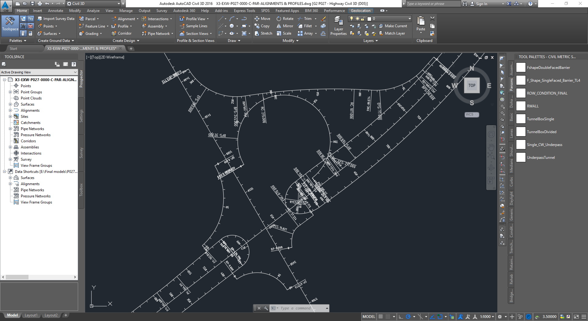
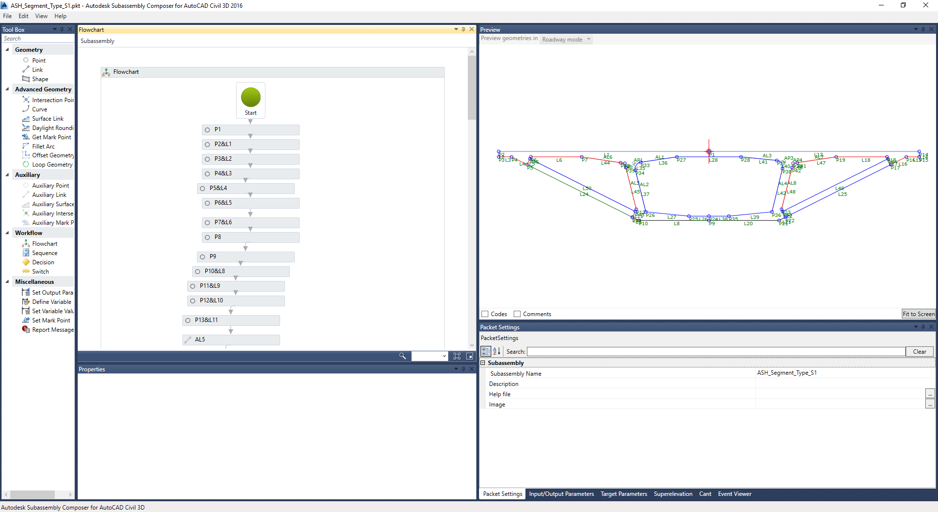
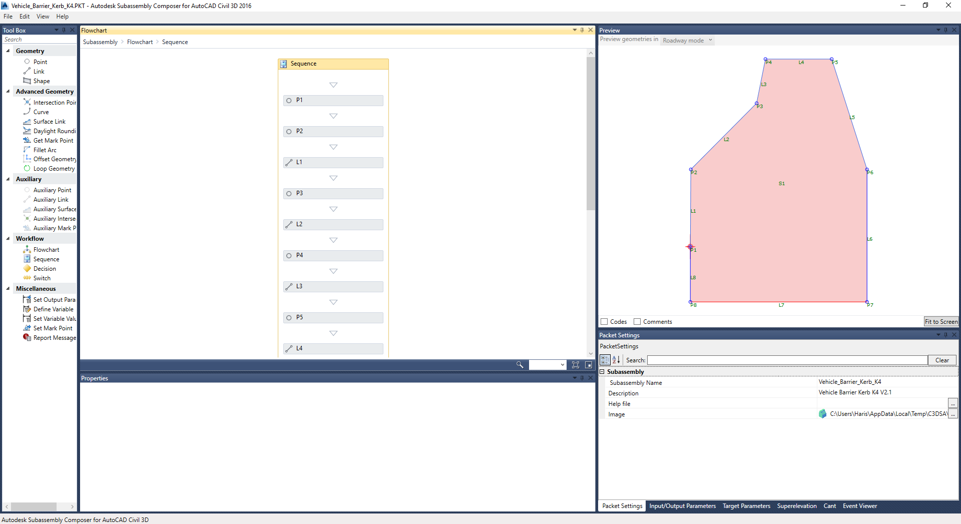
In the process of doing that, I had to create a number of custom subassemblies with the Subassembly Composer. I also had to draw up a document called Civil 3D Model Submission Guidelines in which I had to outline minimum quality requirements for a Civil 3D model to be acceptable by Ashghal (or our client also known as PWA or Public Works Authority). I also had to draw up a couple of other similar documents, one of which were the guidelines for the submission of the Navisworks models, and the other for the submission of visualizations. I addition to this I had to write up a manual for the use of the custom Civil 3D subassemblies that our client was providing to the design consultants in order to enforce standards and uniformity accross all the projects on the Expressway Programme.
I used Civil 3D for the road safety audits as well. I had to create a Civil 3D model based on the alignments, profiles and road cross section, and then create a visualization from it to get a better picture of how the final design is going to look like. A few times I had to calculate the earthworks for a project too. Sometimes I used it to modify alignments and profiles to update a design, and had to create and print profile views. I had to update and maintain the standard Civil 3D templates and subassemblies that were created specifically for the Expressway Programme.
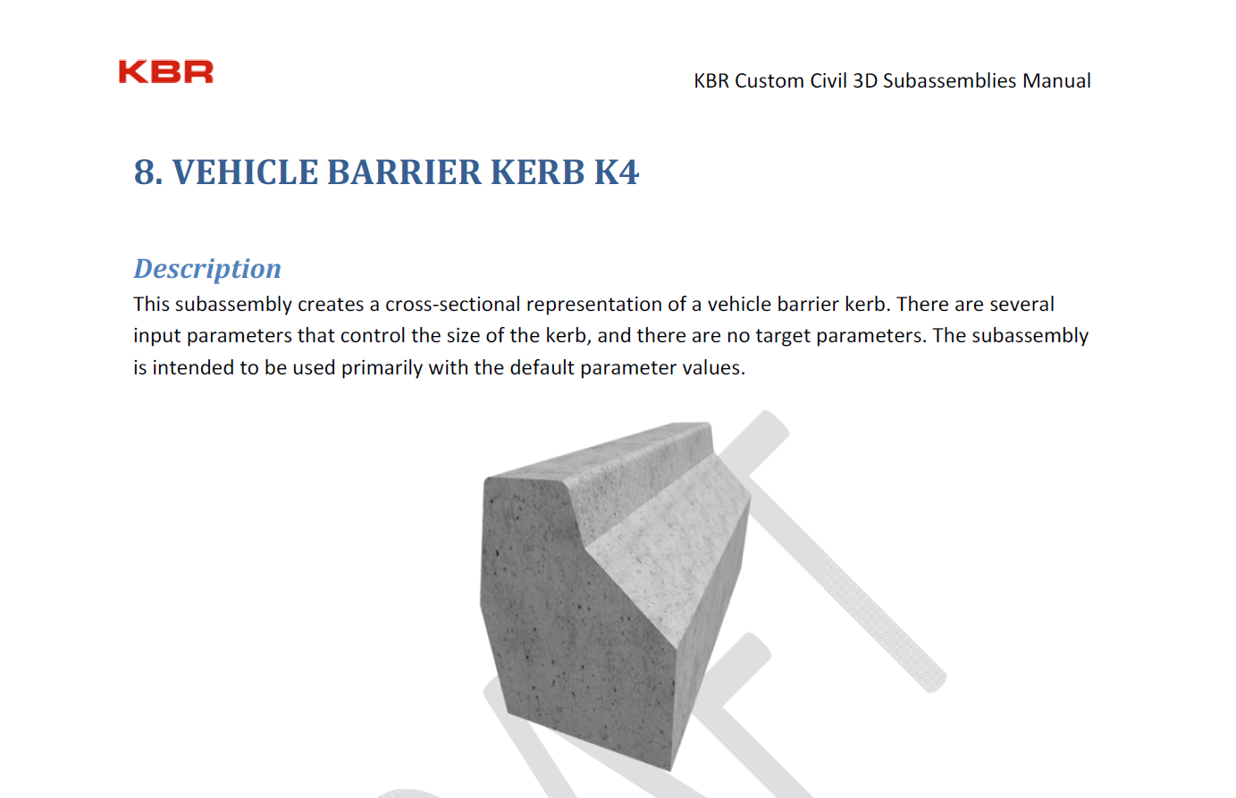
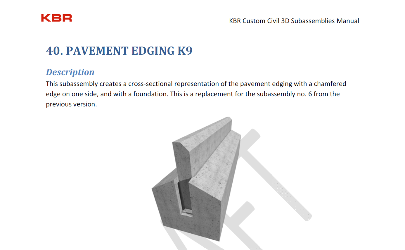
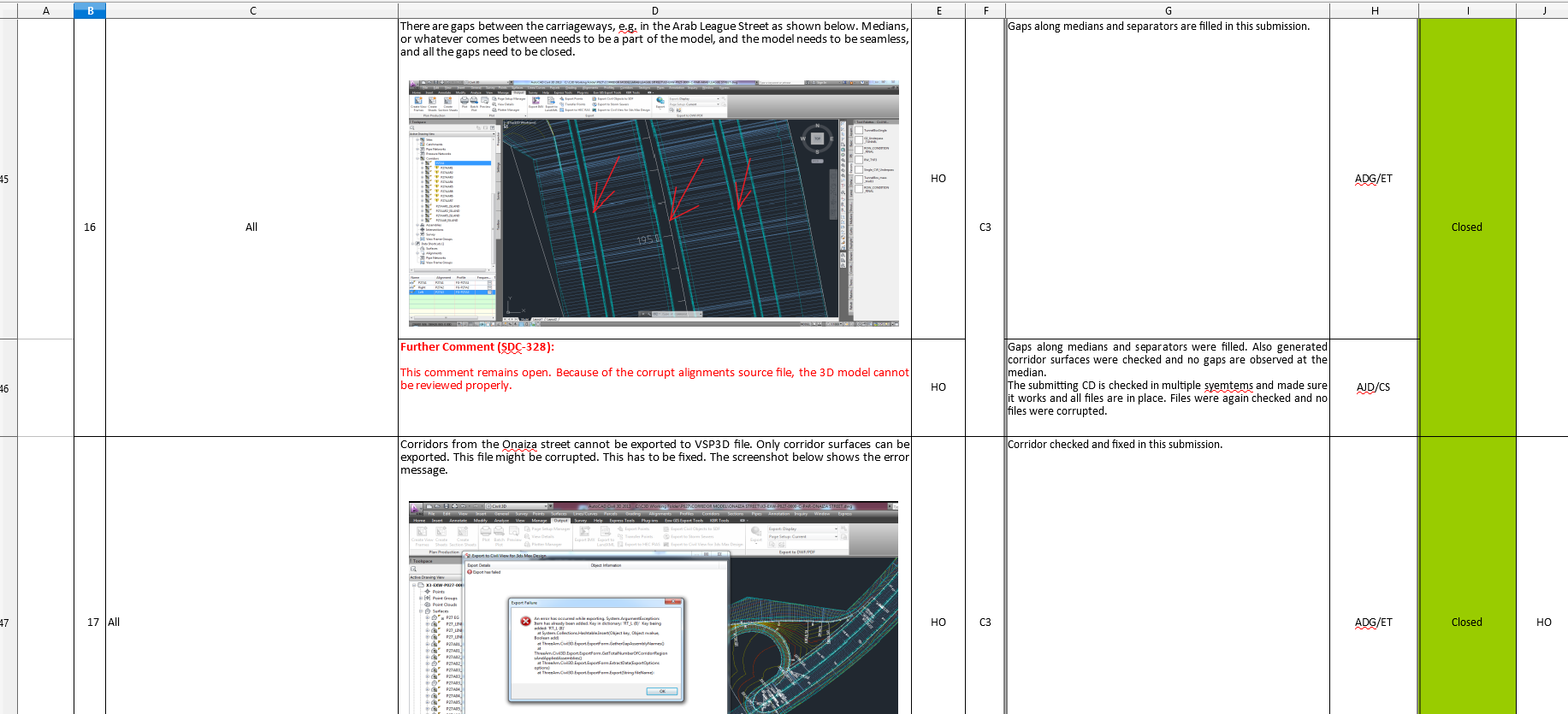
Screenshots below are showing one of the 3D models that Parsons International created. There are also excerpts from the custom subassembly user manual that I wrote up, with the subassembly illustrations that I created in 3DS Max. Third screenshot from below is showing a screenshot from one of my review comment sheets that I used for the correspondence with the design consultants pointing out errors in the 3D models, and then the sheet would go back and forth and the model would be resubmitted until all the deficiencies have been resolved, and the model was deemed acceptable by the Ashghal standards. The bottom two screenshots are showing some of the subassemblies that I created. They are shown open in Subassembly Composer.


Navisworks
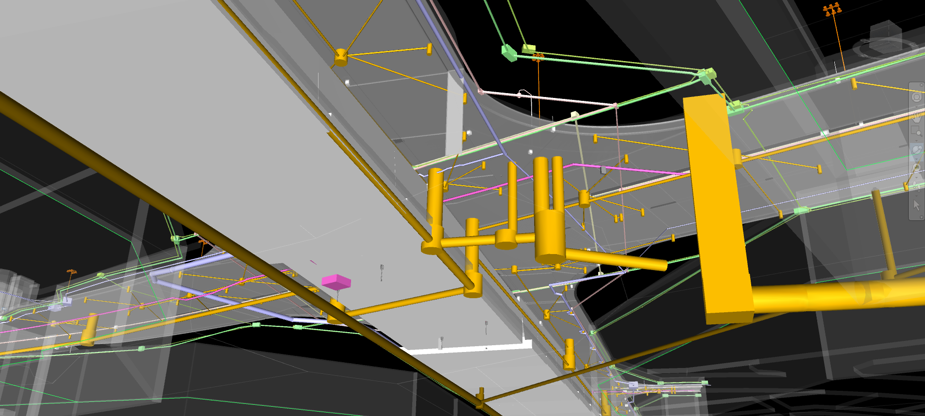
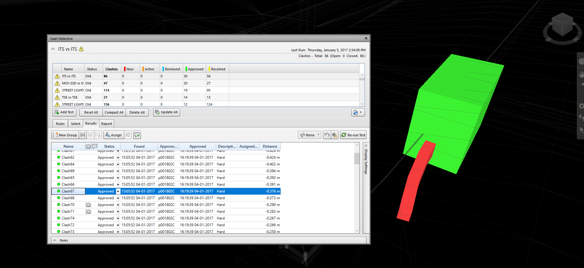
As a part of my job in the capacity of the visualisation technician at KBR, I was reviewing holistic federated Navisworks 3D models of the road model and the utilities that were being built underneath the road. These models were being created for the purpose of clash detection and creation of a clash detection analysis report, and my job was also the review of the clash detection tests and reports. The screenshots below are showing one of the models I was reviewing, created by the design consultants from the Hyder company for the project P026 on the Expressway Programme. On a few occasions I also had to create clash detection tests, and perform clash detection myself if it was not already provided. I would use Navisworks for other purposes as well, e.g. to combine together several 3D models from external files to create a federated model if one was not already provided, for the purpose of clash detection and analysis. I have five years long experience in working with Navisworks 3D models.


BIM

I worked as a design review technician for 3D models and visualizations, and helped the CAD manager with the creation and adoption of BIM standards.
I worked in a CAD team in the role of a visualization technician. We were a team of CAD and GIS technicians
responsible for the review of design consultants' project documentation deliverables.
My job was to review Civil 3D models of the highway designs, and Civil 3D models of the designs of all the dry and wet utilities that
accompany a major highway
project. I also used to review clash detection of these utility models aggregated into a combined 3D model together with the
model of the highway itself. Another major type of deliverable that I used to review were the 3D visualizations of these highway projects.
I must've reviewed close to 200 of 3D models and visualizations for around 30 highway projects that were part of this
programme.
Since BIM was only in the early stages of implementation at the Public Works Authority (PWA),
which was our umbrella company in Qatar, the processes related to it were used independently of each other and not as a tied-in system, and
the term BIM was used only vaguely. A systematic implementation of BIM has only started in the final year of my service at the PWA.
Just around the time when I was leaving the company, PWA has subcontracted a team of people to work on a systematic implementation of BIM accross the entire
organisation. But, it's much harder to implement BIM on such a long structure than on a building project. Civil 3D is crashing a lot,
and the model is split up in a number of Civil 3D 'corridors', and even in a number of files with the use of 'data shortcuts'. This is much
different from Revit where the entire model of a building is in one file. As well, Civil 3D is built on top of AutoCAD, unlike Revit, which brings a number
of issues with it.
The BIM level of maturity at PWA was somewhere brtween Level 1 and Level 2, but closer to Level 2. It was still a far cry from 'Open BIM' and cloud computing.
Level 2 means that each discipline has it's own 3D model,
and the data is attached to the model, and in this case each discipline had it's own Civil 3D model. But it's not possible to attach all the Civil 3D models
together because a PC and Civil 3D would not be able to handle the amount of data and would crash. Civil 3D models are parametric, and they contain all the
paramatric design data in it. They can be updated, and the update affects the entire model. Each discipline had it's Civil 3D model in a separate file, and
in many cases the model was split up in several files because of the size and complexity. There was also the model of the highway which was the most complex,
and it was split up into ten or even more files. Hence, it's not possible to have entire BIM model of the highway and of all the disciplines opened at the same
time in Civil 3D. BIM Level 3 is still an unattainable goal when it comes to road design, because there is no such software available yet that can
handle an entire parametric model model of the road and all the utilities. Civil 3D is built on top of a CAD software AutoCAD, and that limits it. Civil 3D
is no match for Revit.
Level of development (LOD) of the model was in most cases at the level LOD300. Sometimes at LOD400, but only in a few cases.
On the Exressway Programme, combined Navisworks models were submitted as deliverables as well, but then the model was not parametric anymore. The data from
Civil 3D is attached to each object in Navisworks, but the objects loose its parametric nature, and it's not possible to update them anymore. Federated
models in Navisworks can be used for clash detection, 4D simulations, and discussions, but they are not BIM models. Expressway Programme was not fully
BIM-compliant by definition as it has not attained a pure Level 2 BIM. There were other problems plaguing Expressway Programme when it comes to BIM
implementation. Civil 3D designers at each of the design consultant companies were at different levels of proficiency. Sometimes they were just learning,
and the Civil 3D models they were submitting were far below the proscribed standards. During the numerous review cycles, I tried to enforce the PWA
standards, but it was simply not possible because design consultants didn't have good qualified Civil 3D designers. In some cases they were just learning
how to use Civil 3D. Civil 3D is a complex application, so no wonder that there aren't too many people outthere who can use it properly and efficiently.
Another problem on the Expressway Programme was that the submission of Civil 3D models has started late, when the concept designs have been already
submitted, and we were already well into the detailed design phase. Concept designs were all in 2D and in many cases Civil 3D was not even used as the
design tool, only AutoCAD. As a consequwnce of this, concept design that were being submitted were actually created based on the 2D design drawings,
and it could not have any purpose with regards to BIM as the concept design phase was already over. In some cases even the detailed design Civil 3D model
was submitted very late when the detailed design phase was almost at the end, and the construction phase was about to begin. Sometimes Civil 3D model
was submitted even during the construction phase because it was a deliverable as per the contract, and the design consultant or the contractor were supposed
to submit it. Thus, these models were basically and effectively as-built BIM models.
There was no real mechanism to enforce BIM on the Programme as the BIM was never explicitly mentioned as a requirement neither in the DBB nor in D&B contracts.
The BIM implementation team that has been recruited by the PWA will be implementing BIM but only for the future projects. It will be a daunting task
in the light of difficulties related to the highway design projects as I mentioned above. Implementing BIM with the already submitted Civil 3D models
would be a monumental task given the enormous amount of data they would have to process, and the Civil 3D models created at different levels of quality
and sometimes incomplete.
To summarize, I have an extensive knowledge and experience in BIM modeling, but not on the theoretical side of things.
I have practical knowledge of the BIM components when viewed independently. I have not participated in the
creation of a BIM model, but as a design reviewer I have influenced its shaping, and thus gained a great insight into the workings of it.
3D
During my work in the role of a visualization technician at this company, I reviewed many Civil 3D models, and gained an extensive
working experience with Civil 3D which is a BIM application for the road design. Civil 3D is Revit's BIM equivalent for road design.
I was also reviewing animated 3D visualizations of highway projects, and 3DS Max models on which they were based. Visualizations are the
3D segment of BIM as well.
4D
Since we were a PMC, and not in the business of designing but just reviewing someone elses designs,
there was no particular need for the creation of 4D simulations, which would be the 4D part of BIM, time management. Sometimes design consultants were
creating them, but there was no specific clause in the contract that stipulated that implementation and use of BIM was a contractual obligation as part
of the design process. BIM was not a requirement and it was never mentioned in the contracts.
Despite of all this, my experience with Navisworks is very extensive as I had to review many combined 3D models and clash detection tests.
I created a couple of animations in Navisworks, and connect them to a time schedule, to show the construction of a project in phases,
and that is very easy for me since animating in Navisworks in no different than in 3DS Max or After Effects, and I would feel comfortable
creating 4D simulations.
I would also be able to import model to 3DS Max and create more appealing 4D simulations, but they would not be connected with the time schedule then.
An example of a such animation is Substantial Completion which is showing transition from a road that has been open
for traffic but not completed yet (beneficial use), to a fully completed project. This is though just one location on a road that is several kilometers long. It's not
really possible to show the entire structure when it comes to road projects, but only individual locations. It's a different case with buildings as they
are much smaller structures that can fit on one screen.
5D
5D would be the cost management as a part of BIM. As a design reviewer, I had to read DBB and D&B contracts that were signed with the design consultants,
to check whether all the contractual obligations have been met with regards to the documentation deliverables, and
also on occasions to briefly brush up on financial matters, but that was what the quantity survey team was tasked with.
On a few occasions, I used to create a quantity takeoff for the earthworks and materials in Civil 3D for certain highway projects when there was a
need to check whether the figures in the design consultant's Bill of Quantities were accurate, and those were basically the only instances
where I was involved with 5D dimension of BIM.
6D
I did not deal with 6D so much, which is the energy management. I was reviewing the street lighting and electrical distribution network 3D models as a part of the utility Civil 3D models though. I was reviewing also the telecom and ITS networks which are directly related to the consumption energy. Therefore, I may conclude that I was partly involved in work related to this segment of BIM.
7D
Never dealt direcly with 7D, which would be the facilities management. I did, as a design reviewer, do my best though to discipline the design consultants into delivering good quality Civil 3D models which would eventually be used for the operation and maintenance later on, once the construction has been completed.
8D
This part of BIM, logistics and supply chain, was out of scope of my work. This is in the hands of PWA which is taking care that all the highways are kept in good condition once the construction has been completed and the road has been open for traffic.
9D
Safety features of the road are also part of the 3D models which means that the information is already integrated since the start of the designing process, and as a 3D model reviewer, my responsibilty was to make sure all the road safety features are included in the model. Hence, I have a direct experience with this part of BIM. I also contributed in 9D by participating in the road safety audits, thus making the roads safer by making sure that safety facilities are adequate.
Given my .NET programming skills, I would be able to create custom tools in Civil 3D, Navisworks and MS Office applications, that would help with the BIM modeling in the data aggregation into one tightly integrated BIM model. I would be able to use entire range of programming tools including MS SQL or MySQL database, create web applications, mobile and desktop applications that would all be accessing the same database, and even accessing the data in the 3D models and other sources.
Road Safety Audits
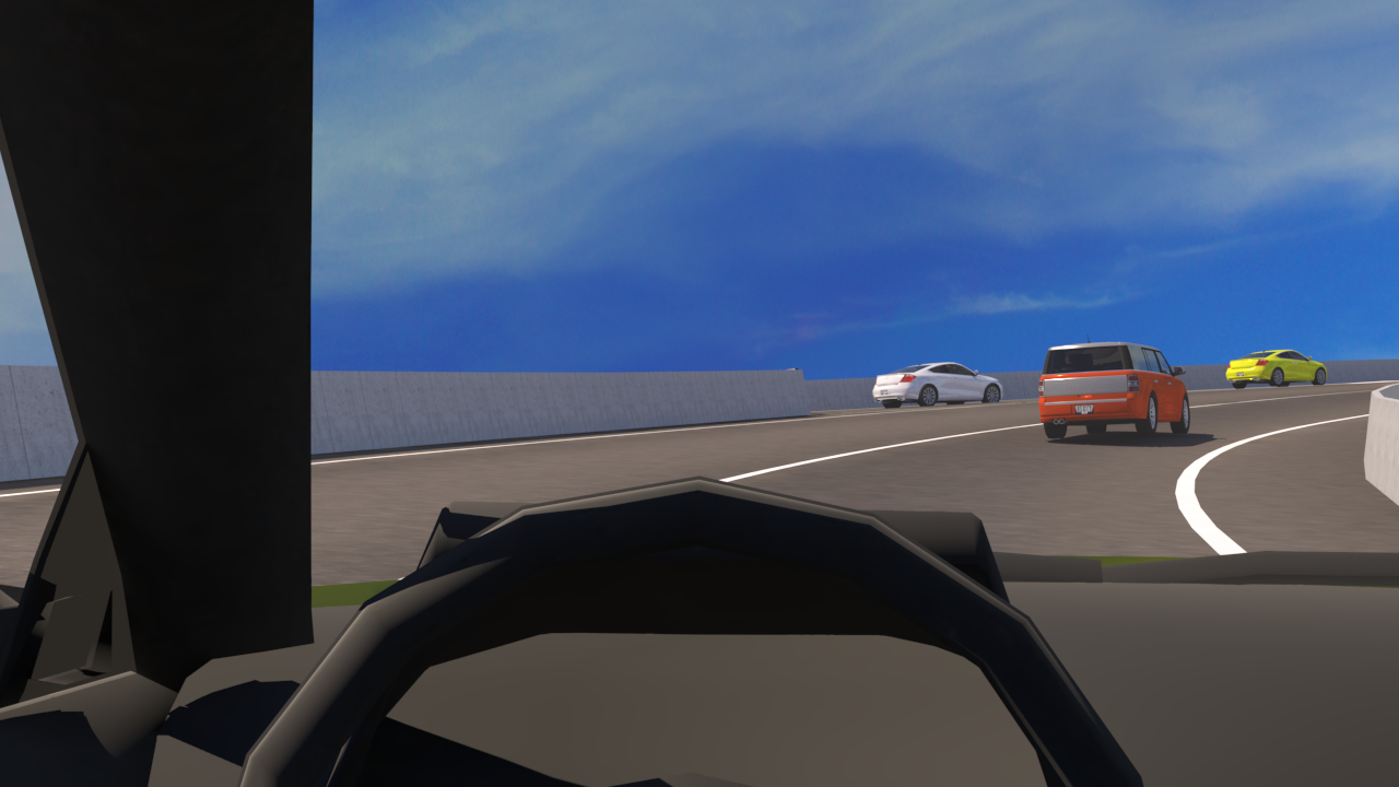
I've participated in a number of road design safety checks. My role was creation of road 3D models in Civil 3D, importing them to 3DS Max, and then creating animated 3D visualizations, like the one shown below. I helped the road design team visualise potentional dangers of a road design, so that the design can be improved.
These are some more screenshots from the safety audits that I worked on


Photogrammetry
At KBR, on the Expressway Programme in Doha, we were exploring the possiblities of usage of photogrammetry drone apps like Pix4D for the purpose of visualization of the as-built stage of the project. Photogrammetry though works much better with simpler and smaller structures like buildings, but since we were dealing with large-scale objects like huge interchanges with complex underpass and tunnel systems, and long uniform stretches of road, it was not so simple to implement photogrammetry. In addittion to that, it's difficult to get a drone flying permit in Qatar because many areas are not allowed to be filmed. Besides, KBR was just the PMC on the programme, and we were not supposed to be doing as-builts ourselves. That was the job of the contractors. Some design consultants like Hyder for example have successfully implemented drone lidar technology for the calculation of earthworks, and they were achieving really good results.
3D PDF
On the Expressway Programme in Doha, we tried to make use of all the new technological trends: photogrammetry, glTF, 3D PDF, VR, AR, aerial drone videos etc. This is a screenshot from a 3D PDF that I made by extracting a part of a 3DS Max model. It can be viewed only in Adobe Acrobat or Acrobat Reader (it doesn't work in a web browser).
XR
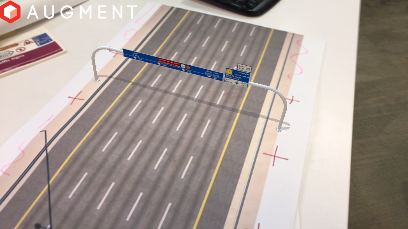
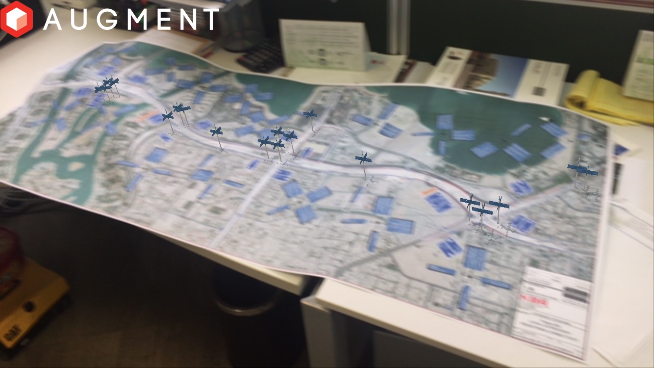
XR is a collective name for the AR, VR and MR technologies. While I was working at KBR, we used AR application Augment for presentations. You can see some
screenshots below showing the directional signs that I modeled in 3DS Max, e.g. the directional fingerboard for the cycle paths, and then imported as vitual
objects in Augment to overlay them on top of the real world.
I've also done some AR programming with the ARKit in iOS. The aim was to make 3D design models appear on the phone or tablet screen at the exact geographic
coordinates where the building is going to be built.


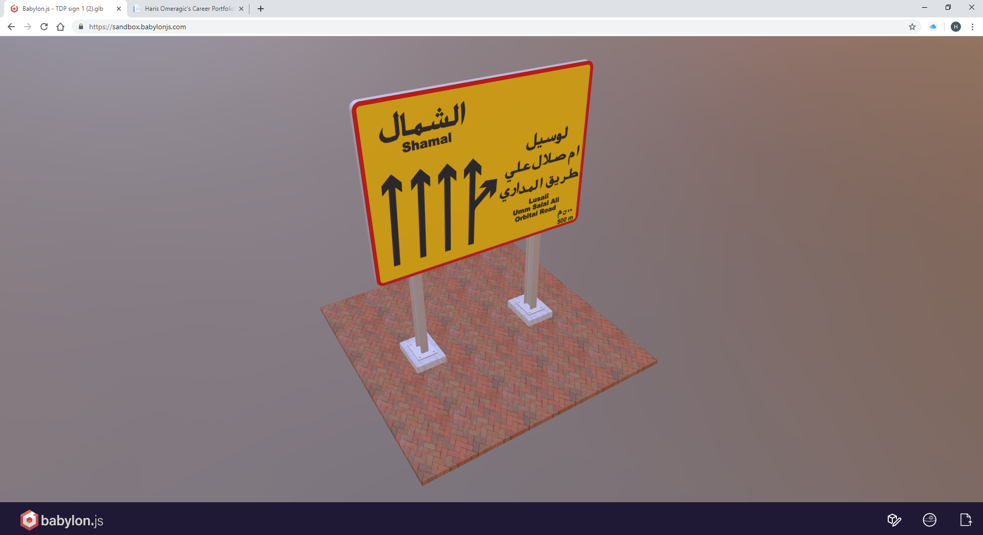
glTF
While I was working at KBR, I created several glTF models. We decided to make use of this technology because of the convenience of viewing 3D models in a web browser. Therefore there was no need for any special software. There was also an add-on for 3DS Max that allowed me direct export of the glb files which are the containers for the glTF models and can be simply drag-and-dropped onto a glTF viewer application in a web page.